It has been over 2 years since GTI began developing GTViewer for iOS, and more than a year has
passed since its release. Version
2.0 will soon be available, and it brings many new features to make GTViewer for iOS even more powerful.
Version 1.0 brought GTViewer datasets to the iOS device (iPhone/iPad)
and gave users the ability to operate without the need of a network connection. Since GTViewer
for iOS looks and feels very similar to GTWeb for iOS, the significance of being disconnected from the
network sometimes gets lost. The almost 15 year
old code base that drives GTWeb Server and also shared with GTViewer for Windows could not
be leveraged on the iOS platform; so, everything had to be created again from
scratch.
GTViewer for iOS Version
2.0 provides a multitude of fixes, tweaks, and minor enhancements; it keeps pace
with the progression of iOS itself (iOS 5 to iOS 8); and it addresses several
user requests. The most prominent new
features are:
- Redlines – Basic redlining support has been added. Users can now draw and edit rectangles, circles, text, and freehand. A new server application called GTShare has also been created to manage
these redlines. Users can post selected
redlines to the server and can retrieve redlines that other users have
posted. GTShare also supports GTViewer
for Window and GTViewer for Android,
so redlines can be shared between any of these users.
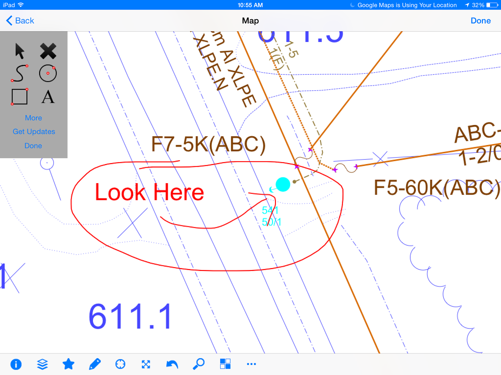 |
| Draw Redlines on your iPad |
 |
| See Redlines in GTViewer for Windows |
- Raster
Backdrop Support – While GTViewer
for iOS does not yet support native raster backdrop images (MrSID or ECW) on
the device, version 2.0 does provide ability to retrieve the backdrop imagery
from a GTWeb Server (which does
support MrSID and ECW) for the current view.
Retrieving the backdrop image for your current view requires a
network connection to download, but the user can keep a number of these images when
disconnected. Many devices do not have
enough storage capacity to hold a full raster backdrop imagery dataset, so this
alternative to native support may actually turn out to be more useful in the
long run.
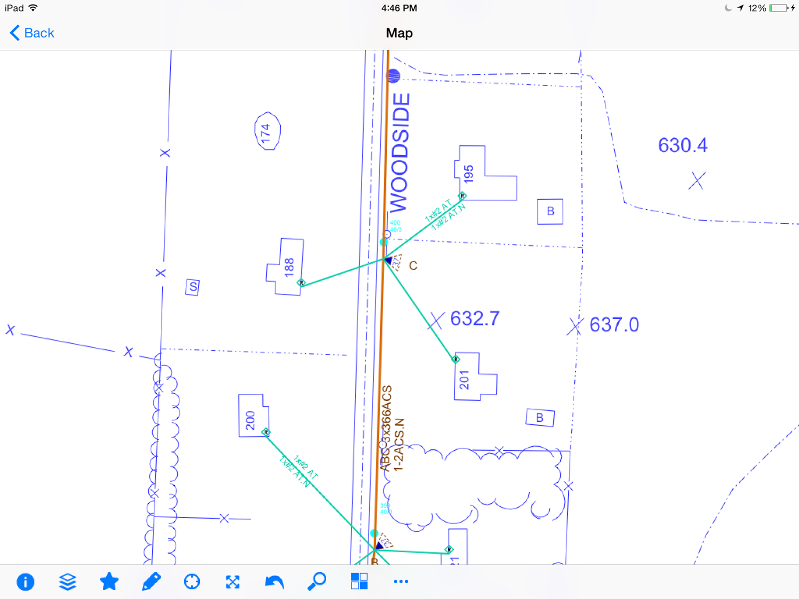 |
| Find an area you want to see backdrop Imagery. |
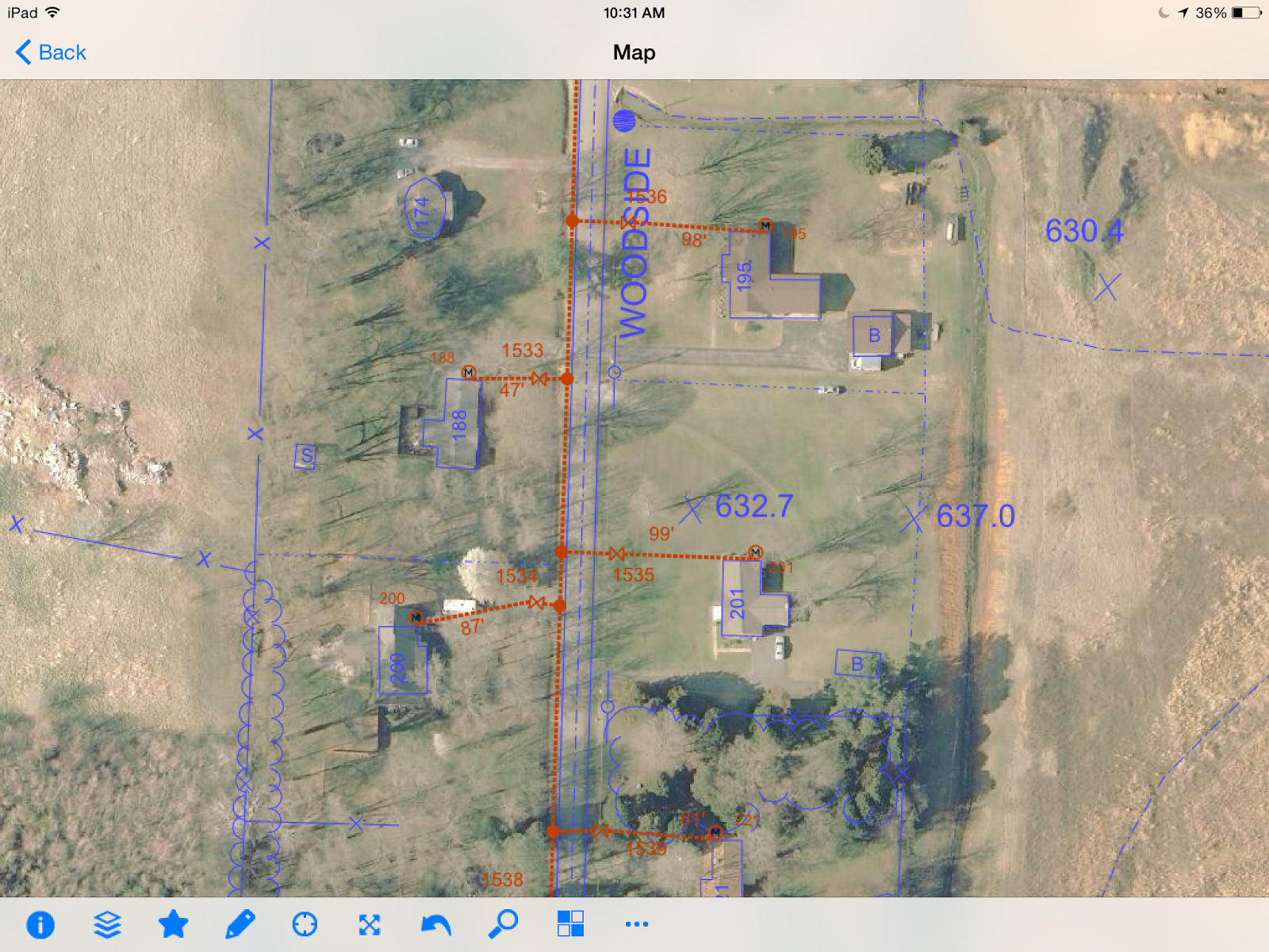 |
| Download Imagery for Current View. |
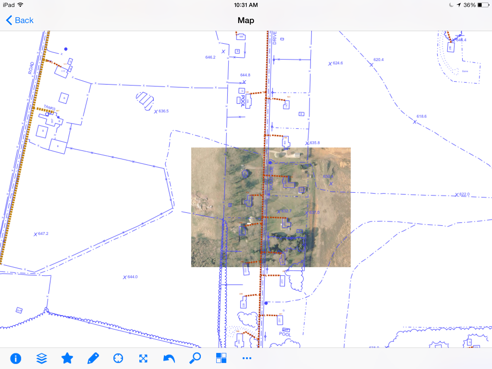 |
| Downloaded Imagery is still available offline. |
- Where Am
I – Any tap on the in the map view will display an Attribute Info pop up
showing the current location's X/Y and Latitude/Longitude values. If you are
reviewing a feature, this info will be at the bottom of the
feature’s attributes. It is also
possible to create custom Where Am I functionality so that a set of polygon
features in the data will be searched to see which ones contain the point (similar
to the Where Am I functionality in GTViewer and GTWeb).
 |
| Standard Where Am I shows Coordinate Info at any point. |
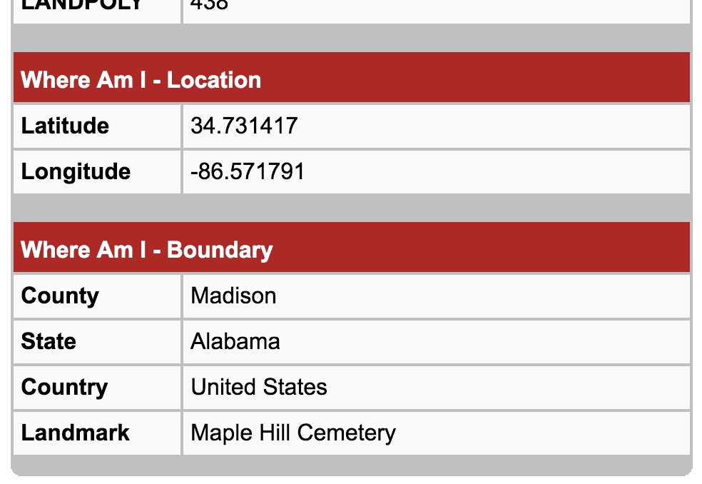 |
| Customized Where Am I shows data specific info. |
- Driving
Directions – Leveraging the power of other applications on the device,
Version 2.0 can now kick off the Google Maps app from any point or feature in its map. Google Maps will then route you
from your current location to the specified destination.
Review a Feature, Press Directions button.
Google Maps is launched with feature's location as the destination.
- Developer’s
Framework - just as GTViewer for
Windows has a set of tools for the developer to create applications with
GTViewer functionality, the GTViewer
Framework for iOS packages up the code-base used by GTViewer for iOS and makes this
functionality available to iOS developers to use in their applications.
This Framework is roughly equivalent to the GTViewer Objects (used with .NET) and provides a set of objects
capable of reading a GTViewer dataset. Full map rendering with panning, zooming, and
feature selection
are also provided.


